
Argentina & Antarctica
- Travelogue: Iguazú Falls and Buenos Aires
- Travelogue: Argentina & Antarctica! Ushuaia
- Travelogue: Argentina & Antarctica! Cape Horn
- Travelogue: Argentina & Antarctica! Ice & Islands
- Travelogue: Argentina & Antarctica! Penguins!
Today we continue my What I Did On My Winter/Summer Vacation essay, moving south to Cape Horn.
Cape Horn
I’ve known about Cape Horn (Cabo de Hornos) for years, the Age of Exploration and how deadly the transit was at the bottom of the world. I’ve read about it so much and always in such a historical context that it was nearly mythical.
And to be fair, it is a place of near legend. One of the, or possibly the, most dangerous ship passages on the planet, the Cape experiences gale force winds nearly 30% of the time in winter, with drifting icebergs and steep waves — including frequent rogue waves of up to 100 feet (30 meters). Winds rushing unchecked across the whole of the Pacific are funneled into the Drake Passage by the Antarctic peninsula and the Andes mountains, just as the massive waves they create come into a shallower stretch of ocean and grow steeper.
At least 800 ships have died here, with over 10,000 mariners. This place did not get its reputation lightly. The Spanish, rather than shipping their gold back to Europe around the Horn, opted instead to carry their extremely heavy loot across the continent through hostile territory, thinking it less difficult and risky.
Having steerage way, the vessel met and rose over the first [wave] unharmed, but, of course, her way was checked; the second deadened her way completely, throwing her off the wind; and the third great sea, taking her right a-beam, turned her so far over, that all the lee bulwark, from the cat-head to the stern davit, was two or three feet under water.
Captain Robert FitzRoy of the HMS Beagle
For a moment, our position was critical; but, like a cask, she rolled back again, though with some feet of water over the whole deck.

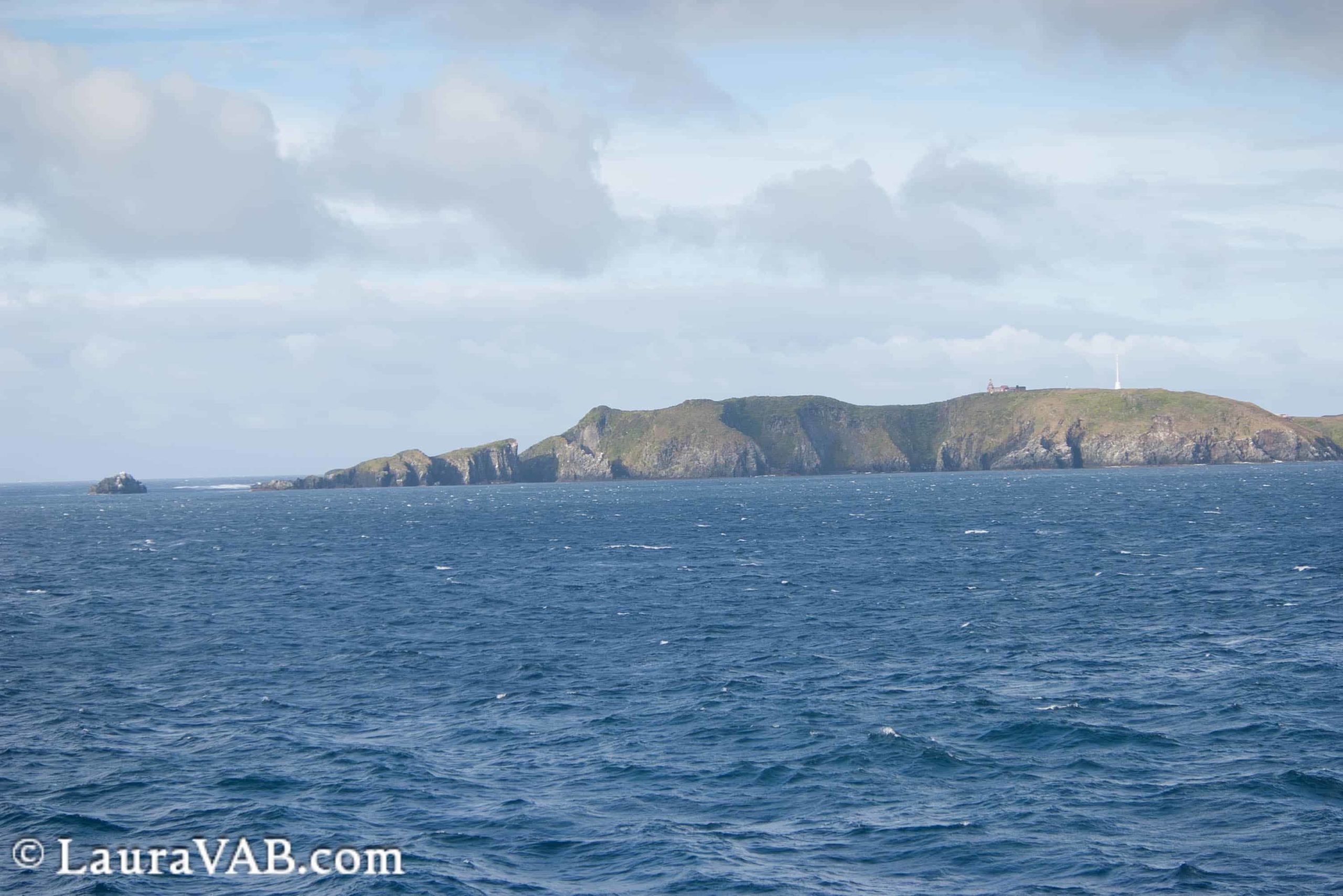
We came to the Horn in summer, on a day which began rainy but not stormy, but you can still see how the area could be deadly, and even more so in the days before fancy charts and GPS. The Teeth of Deceit (nobody does place names like frustrated sailors) might look in the fog like the Horn itself, and if you completed your turn too soon, that would take you straight into the confluence of the Pacific and Atlantic and the jagged rocks waiting to tear your ship apart.
Not to point out how rough the region was for early explorers, but Cape Horn was known for eight years before anyone realized it was an island rather than part of the mainland. It was just that difficult to navigate. How difficult was it? Well, the HMS Bounty attempted for a full month on her outward voyage before the infamous mutiny to get around the Horn, before just turning around and going all the way around Africa and across the Pacific from the opposite direction as a simpler solution.
Let’s just review that — they determined it was easier to just circumnavigate the long way around most of the planet than to get around those few islands. Wow.
We, on the other hand, were blessed with nearly ideal conditions on this trip, and we could plainly see the passage north of the island and even the visible confluence of the two oceans. (The weather was so mild, in fact, that even the confluence was chill. It’s the darker line of disturbed water just below the horizon in the photo.)

(When I went to search for a better photo to share of the confluence, I found a whole internet hole of “the two oceans don’t mix!” with some dramatic and misleading images. Of course the oceans mix, there’s not a really big sheet of Plexiglass between them. Saline and temperature differences mean there’s a sort of boundary where the waters meet, because different densities don’t mix well immediately, but they’re all going to blend, thanks to wind and wave action.)

And then we approached the Horn itself.
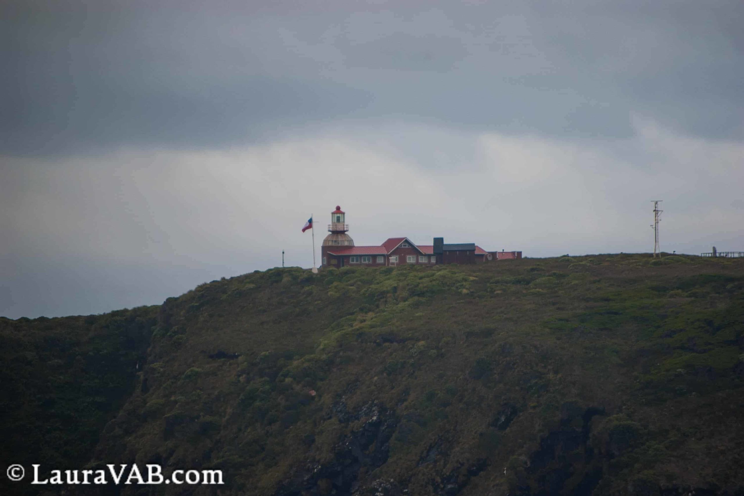
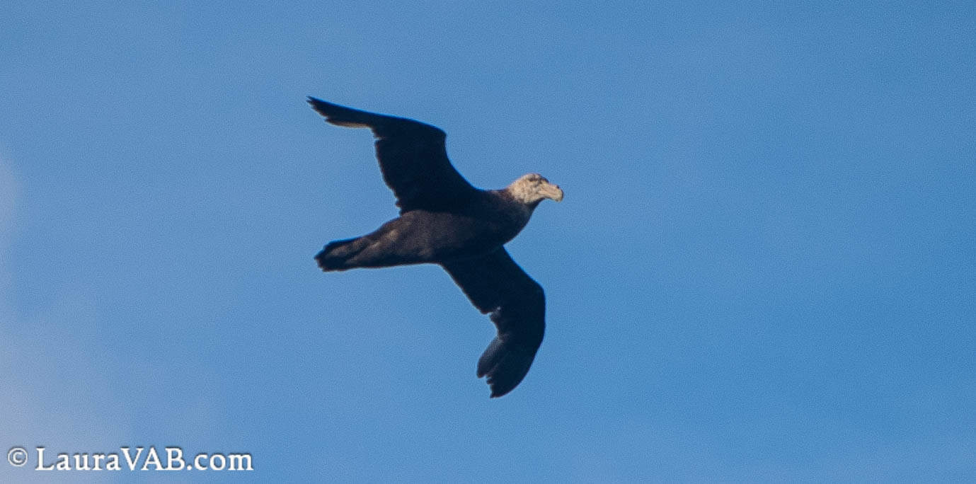
On the island is a manned lighthouse, where a Chilean navy sailor earns double pay for this windy duty. On the hills you can see a chapel, a lighthouse, and a sculpture. Yes, there’s art at the end of the world! This is the monument to the albatross and the lost mariners who died in these waters, created by José Balcells and featuring a poem by Sara Vial. It was raised in 1992 by the Cape Horn Captains Brotherhood.
Soy el albatros que te espera
en el final del mundo.
Soy el alma olvidada de los marineros muertos
que cruzaron el Cabo de Hornos
desde todos los mares de la tierra.
Pero ellos no murieron en las furiosas olas,
hoy vuelan en mis alas,
hacia la eternidad,
en la última grieta de los vientos antárticos.
I am the albatross that awaits you
at the end of the world.
I am the forgotten soul of the dead mariners
who passed Cape Horn
from all the seas of the world.
But they did not die in the furious waves,
Today they soar on my wings,
towards eternity
in the last crack of the Antarctic winds.

You can find some truly gorgeous photos of the monument and island in this PDF from the Museo Chileno de Arte Precolumbino. The albatross monument is made of two multi-layered metal wings which form an albatross in the negative space between them. Note that even the metal sculpture has been flattened by the local winds and repaired. (This photo was not taken by me; I’m including it to give you a better idea of the sculpture’s size, as my photo had no people for reference.)
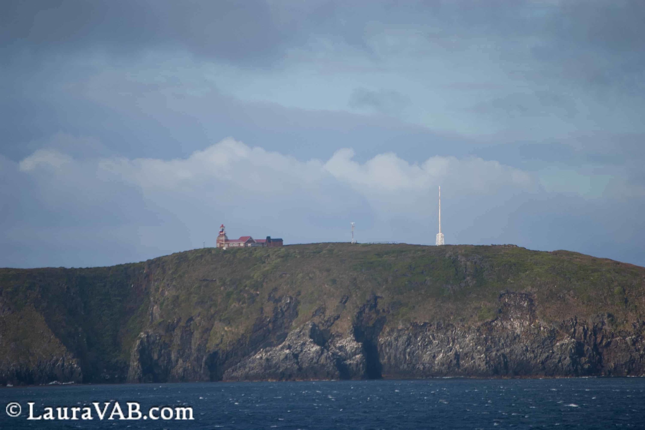
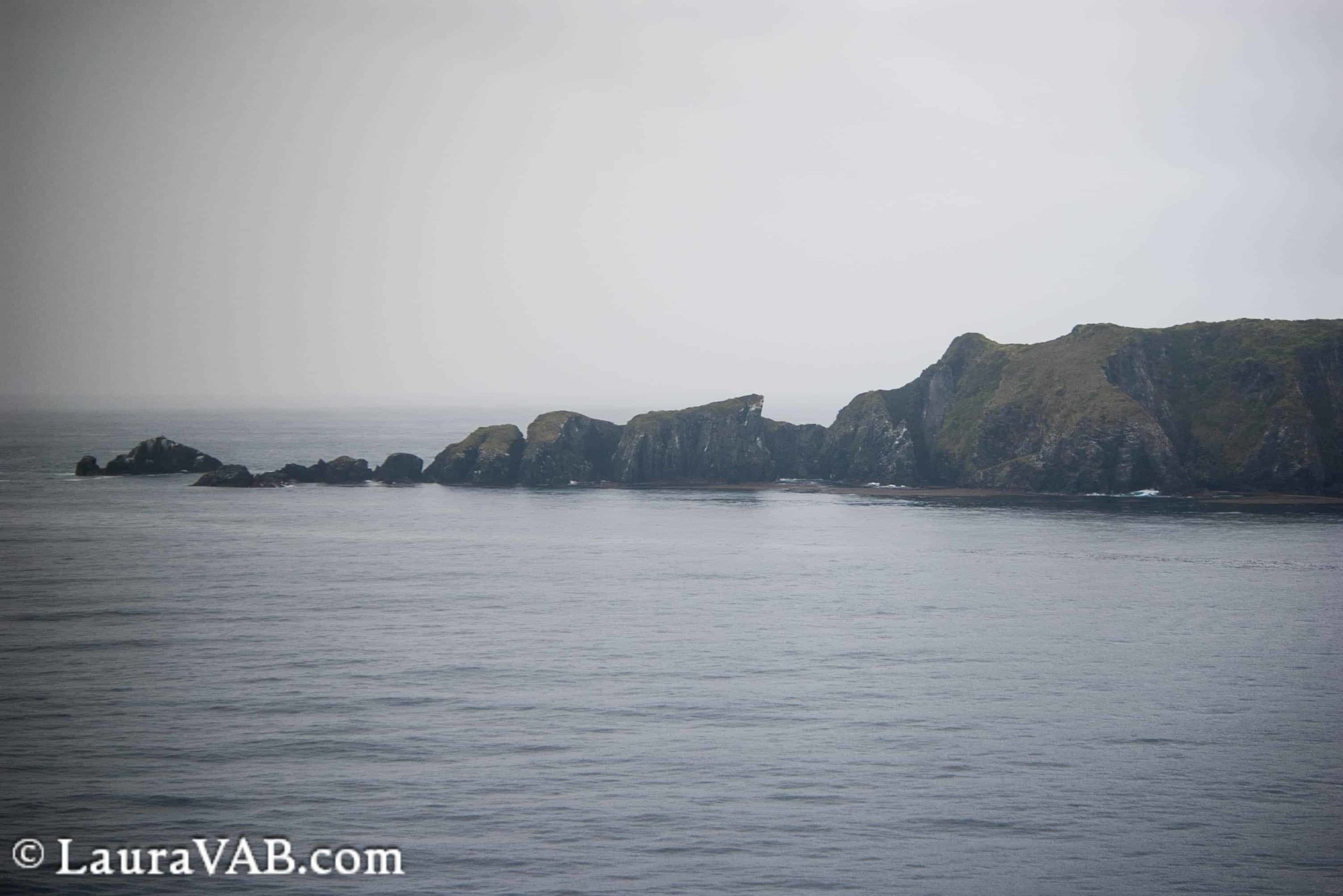
The cape itself sits at the southern tip of Isla Hornos and is roughly a mile from the lighthouse. If you compare the shapes of the cape and the Deceit photo above, even taken from opposite angles, you can see how easy it would be to mistake them in imperfect visibility.
And then at last we crossed to the south and I was able to take this photo proving I had actually passed the infamous Cape Horn:

Fun fact: Cape Horn is not named for any pointy resemblance or shape. Isaac Le Maire and Willem Schouten organized and funded an expedition to seek out an alternate route to the Dutch East India Company’s monopolized Straits of Magellan and Cape of Good Hope. Their ships were the Eendracht and the Hoorn, the latter named for Schouten’s hometown in Holland. The Hoorn was wrecked (all crew saved aboard the Eendracht) but survived in the name of the southernmost point of land.
Next: On to the Southern Ocean and Antarctica!
I like these travel logues