
GDB & Route 66
- Route 66: Ruins and Ghost Towns
- Road Trip! the First Part
- “I Can Only Do This Once”
- Goodbye to Mindy
- Hiking the Redwoods
- Art of the Ukiyo, the Floating World
- Highway 1 and Elephant Seals
- Route 66: The Mother Road, The Road of Dreams
- Route 66: California
- Route 66: Amboy and Roy’s Cafe
- Route 66: Arizona, part 1
- Route 66: Notes From the Mother Road
- Route 66: Arizona, Part 2
- Route 66: New Mexico
- Route 66: Remote 66
- Route 66: Texas
- Route 66: Classic Signs
Here’s a bit of Route 66 background, if you’re coming in late. If you’re all caught up, start the journey below!
The Drive
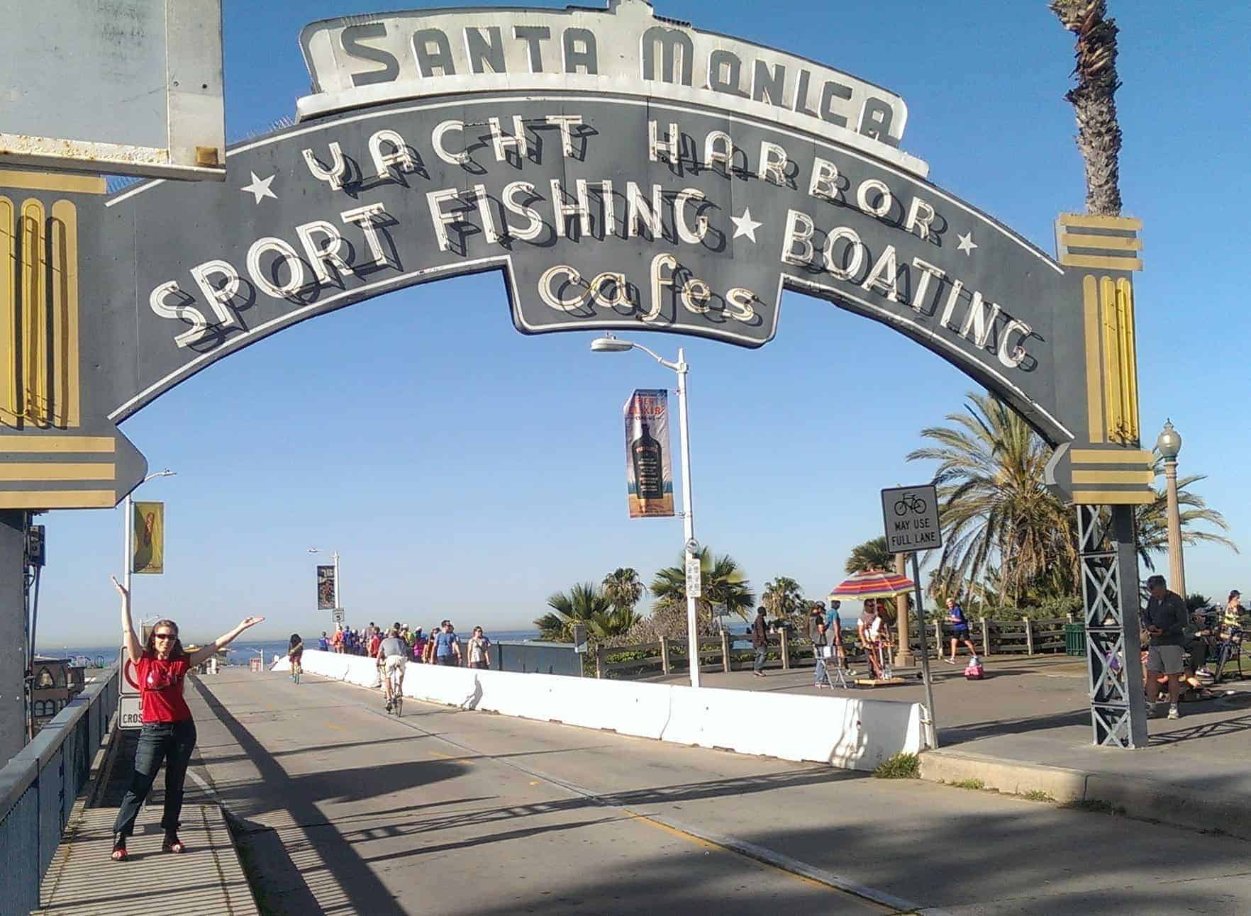
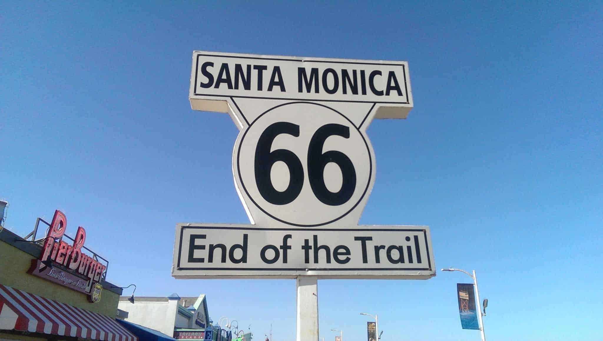
My plan was to drop Mindy at Guide Dogs for the Blind and then take Route 66 back to the Midwest. We started from Los Angeles to run eastward. The actual official end of the road, a couple blocks from the coast, is rather boring, so everyone collaboratively declares Santa Monica Pier to be the figurative end.
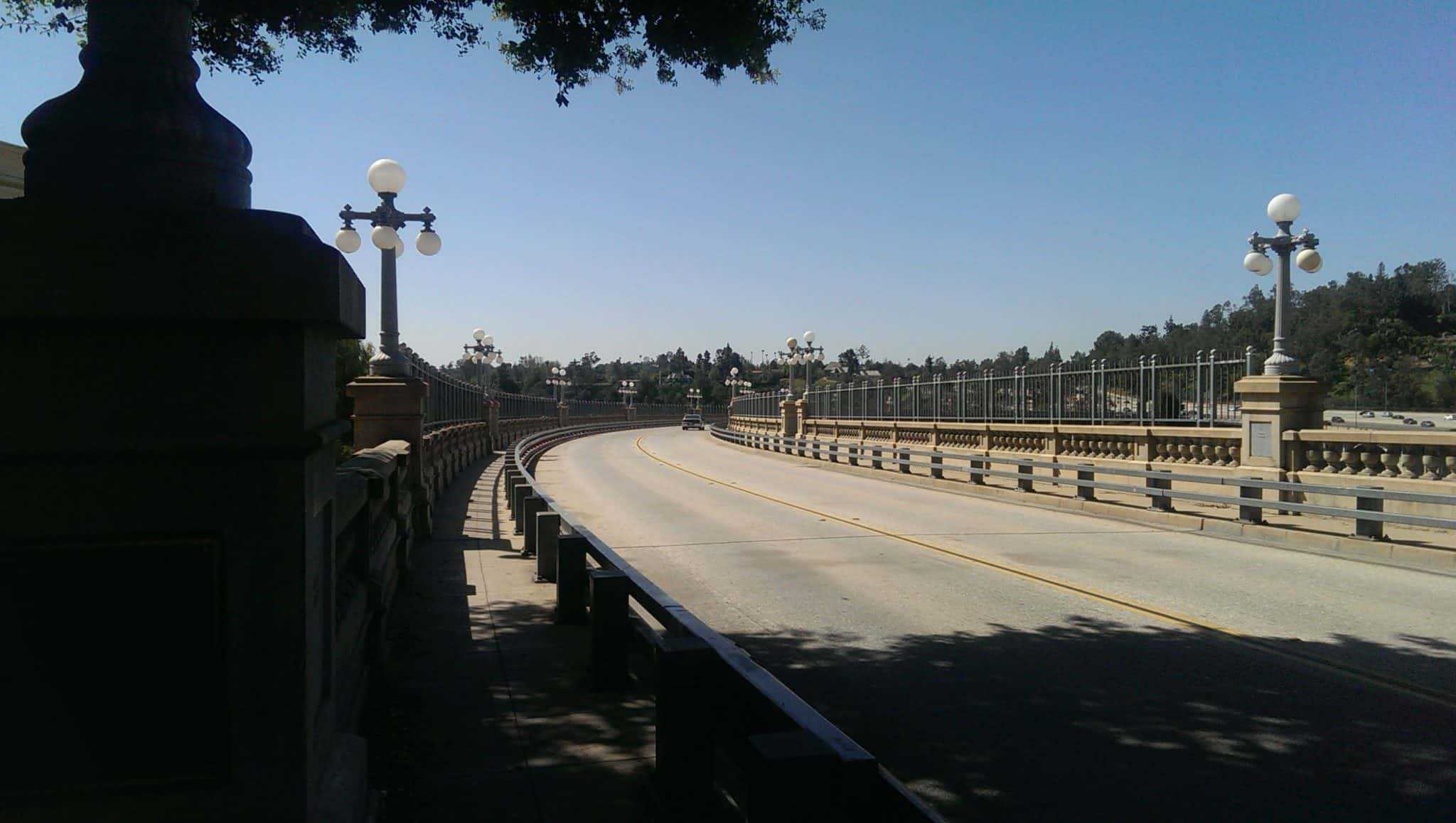
We took a detour at Glendale to meet a trainer friend and a dog she wanted me to see, and then we picked up 66 again to cross the “suicide bridge” over the Arroyo Seco and have lunch at the Fair Oaks Pharmacy.


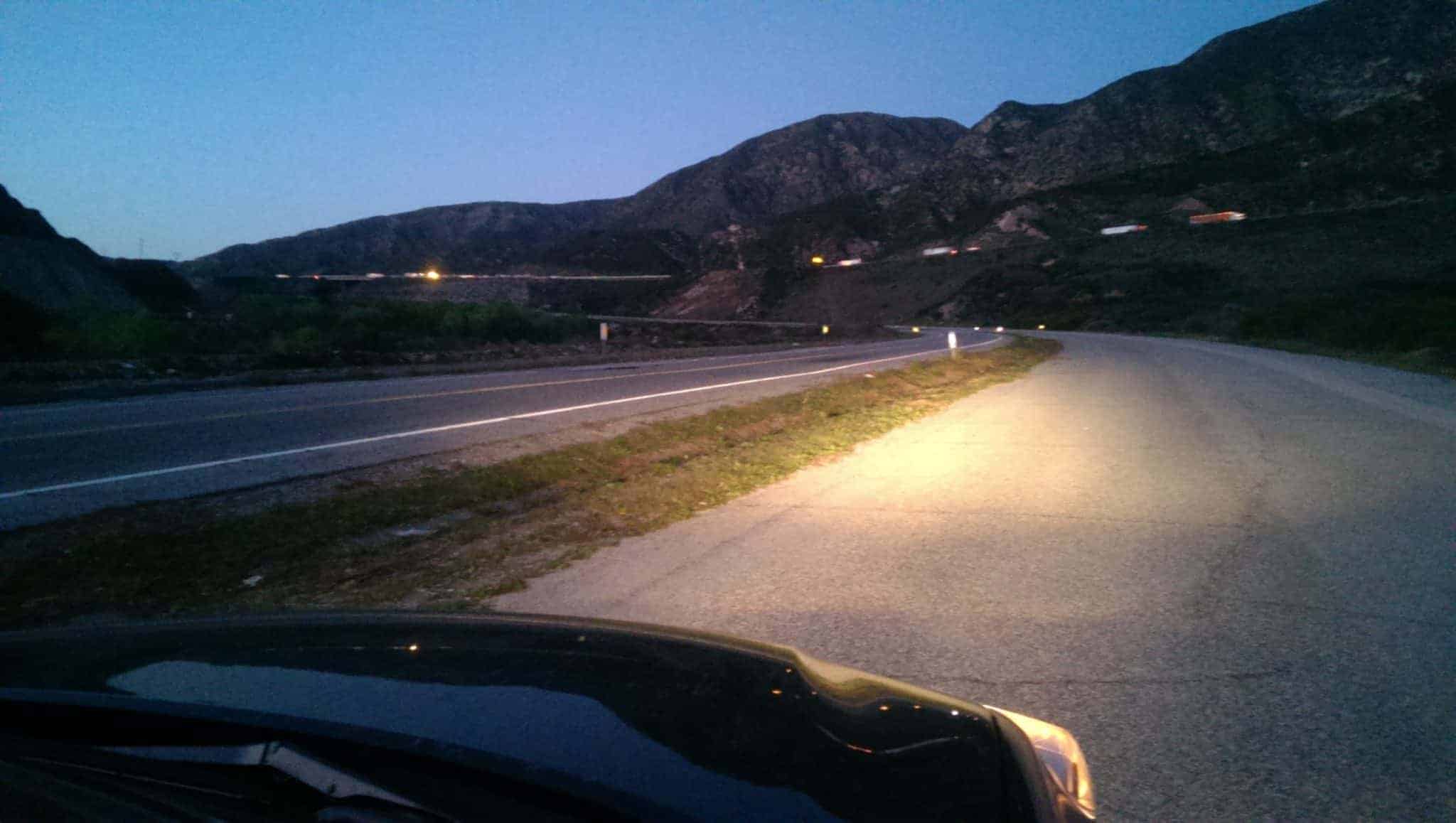
After a delicious lunch (and enormous — there was a full pint of ice cream in my milk shake, no kidding) we caught the road again and headed east. The route out of LA is necessarily slow, but there are a lot of old road visuals to make it interesting. (And if you wanted only speed, after all, you’d be on the interstate — which might help you anywhere but in LA.)
California
Some of my favorite photos on the way out of LA and going east:


Because I am a completist, or hard-core, or just (as my husband suggests) a bit obsessed, we tracked down disused parts of old Route 66 and found a way to drive on many of them, too. Note: we do not trespass on what is now private property, of course. But what is still public road, just no longer on maps or marked or maintained? That’s fair game.
This section of old 66 is now a BMX and off-roading course. We got some stares from some unloading bikers as we drove my Highlander by, but hey, it’s an SUV, and we could handle it.


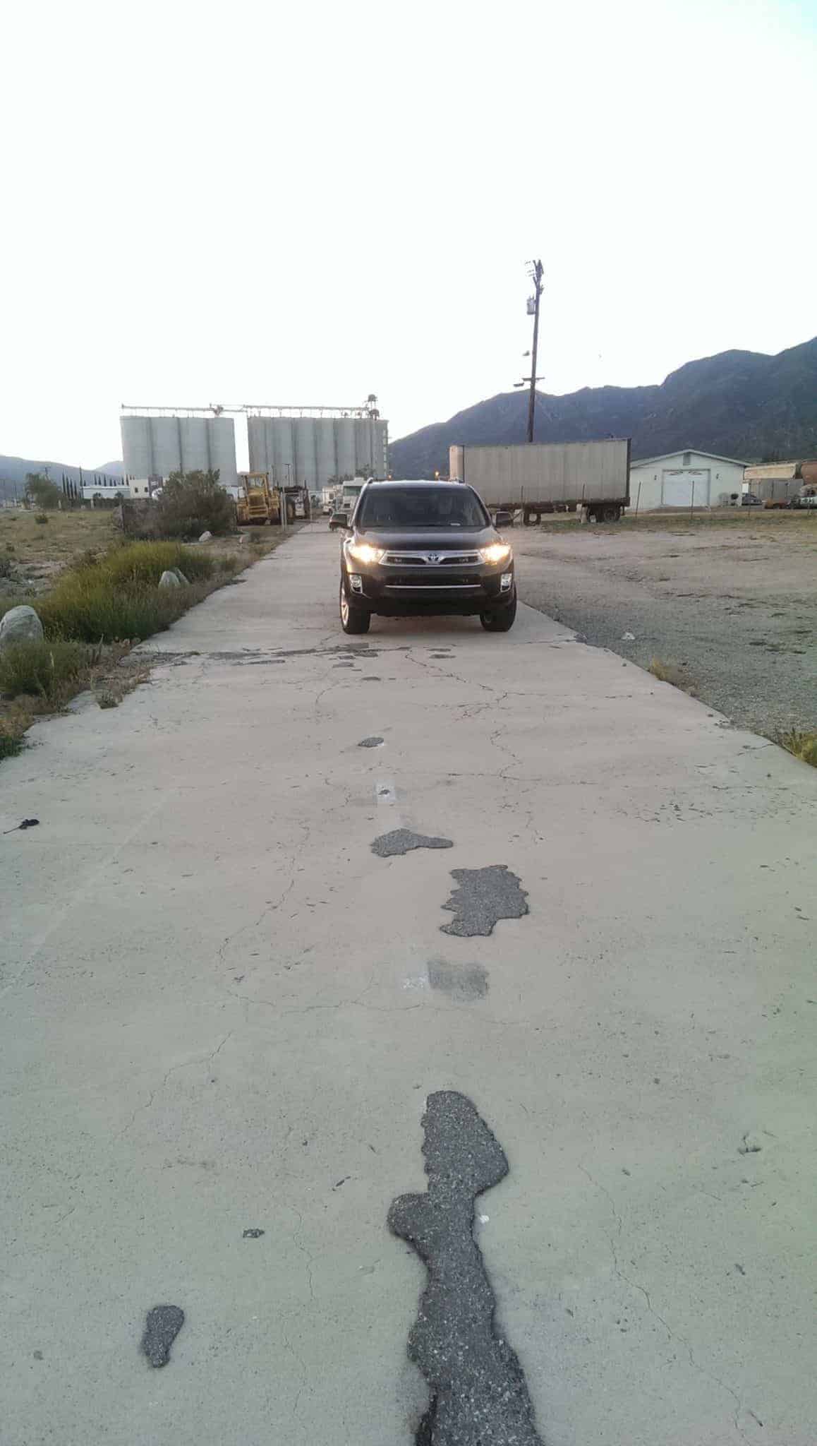
This old section (right) used to cross the railroad tracks and now is a driveway into a maintenance area.
This section (left) runs right alongside the newer road — why they didn’t just upgrade the existing road, instead of wasting taxpayer dollars to start from scratch, is beyond me. But we drove on the old road anyway. Rebels.
We stopped at the Summit Cafe in the Cajon pass, which has reopened since a drunk car thief (alleged, I guess, as I don’t know if he’s been convicted yet) put a stolen car through the building last year. The cafe is famous for their ostrich burgers, so I decided to have one for breakfast. Like an adult.
Me: I’d like an ostrich burger, please.
Waitress: We’re out of ostrich burgers, I’m sorry.
Me: No! I am going to flip this counter, right now. Watch me. Okay, maybe I’ll have a bison burger instead.
Waitress: I’ll just tell you it’s an ostrich burger when I bring it, okay?
Me: That works. Could I have some avocado on that?
Waitress: There’ll be an upcharge, is that okay?
Me: Go ahead and upcharge, you’re already lying to me.
Waitress: Yep, lying and upcharging, that’s our great customer service here!
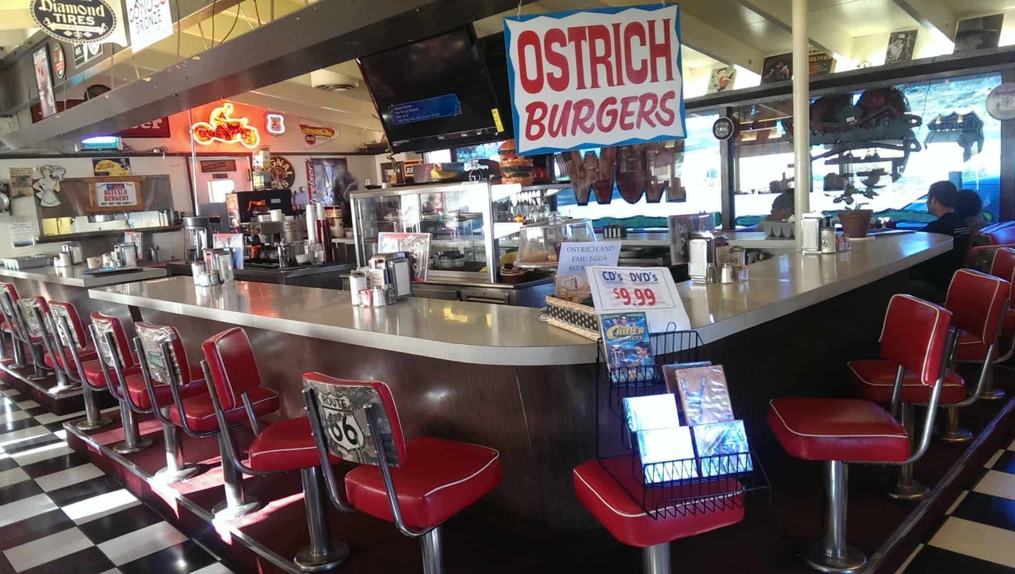
She was fantastic, actually, and if I lived locally, she’d be my Angie (from Agent Carter). Almost worth becoming a morning person to have breakfast there.
Eastward!
Near Helendale, you can find the Bottle Tree Ranch, where folk artist Elmer Long creates trees and more from junk he finds in the desert. Elmer says he does it “to keep busy,” but he’s obviously got a passion.


More photos, from before and after the Bottle Tree Ranch:


I was driving though the Mojave Desert, which is miles and miles of nothing but miles and miles, when we spied something white in the distance. “What’s that?” Jon asked.
“It looks like a fu dog,” I said. “But that doesn’t make any…. It is a fu dog!”
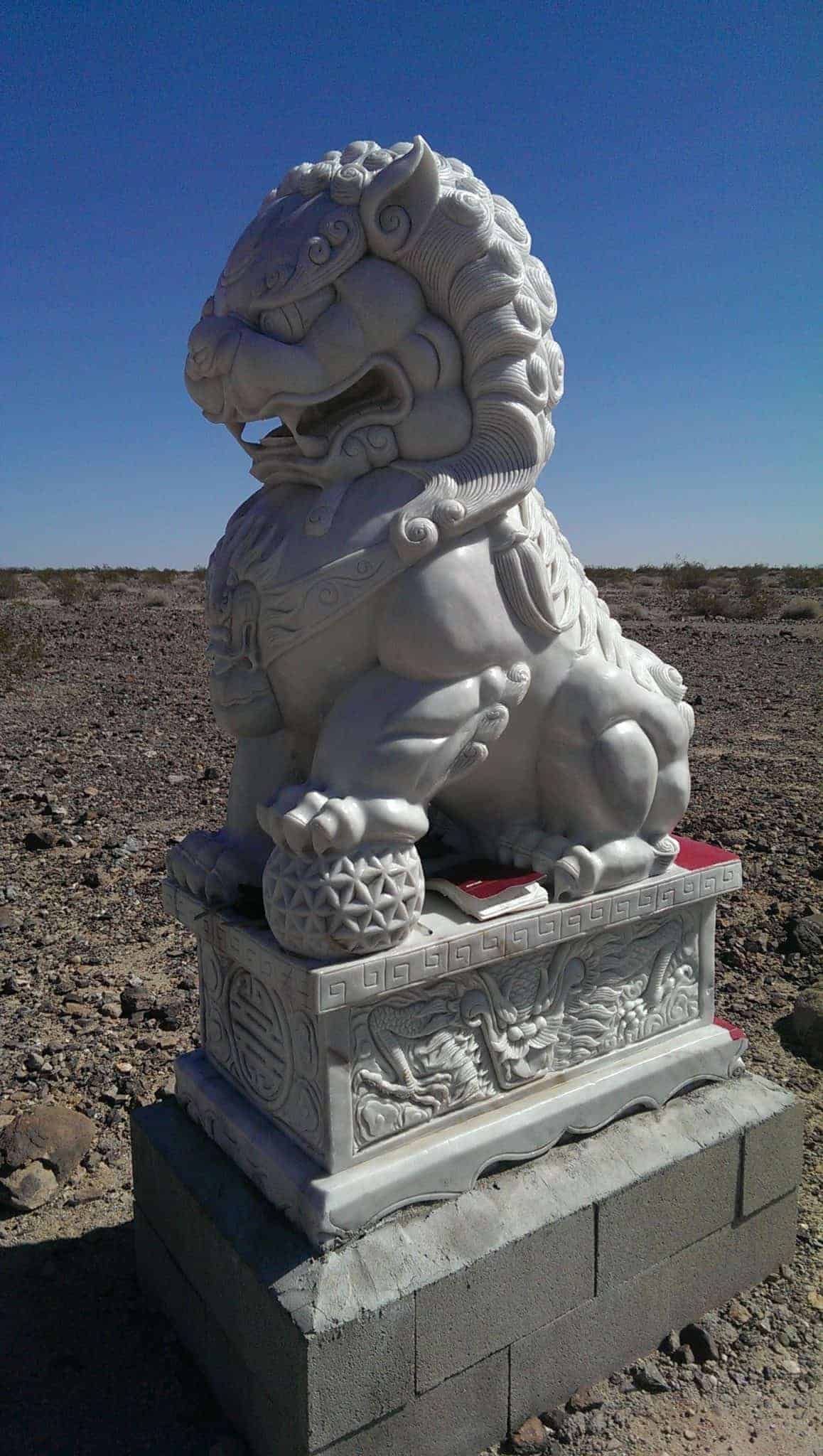
A local biker/photographer, who was shooting the Fu Dog when I pulled over, said he’d heard some property had been purchased “for a nirvana place” and two fu dogs had been set at each end of the property to purify the area. They’d been there a year and a half or so, but he hadn’t heard any more about the nirvana place.
There were some offerings on the dog when I walked out to it.
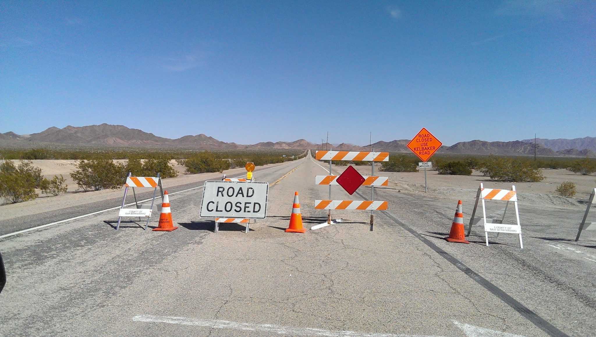
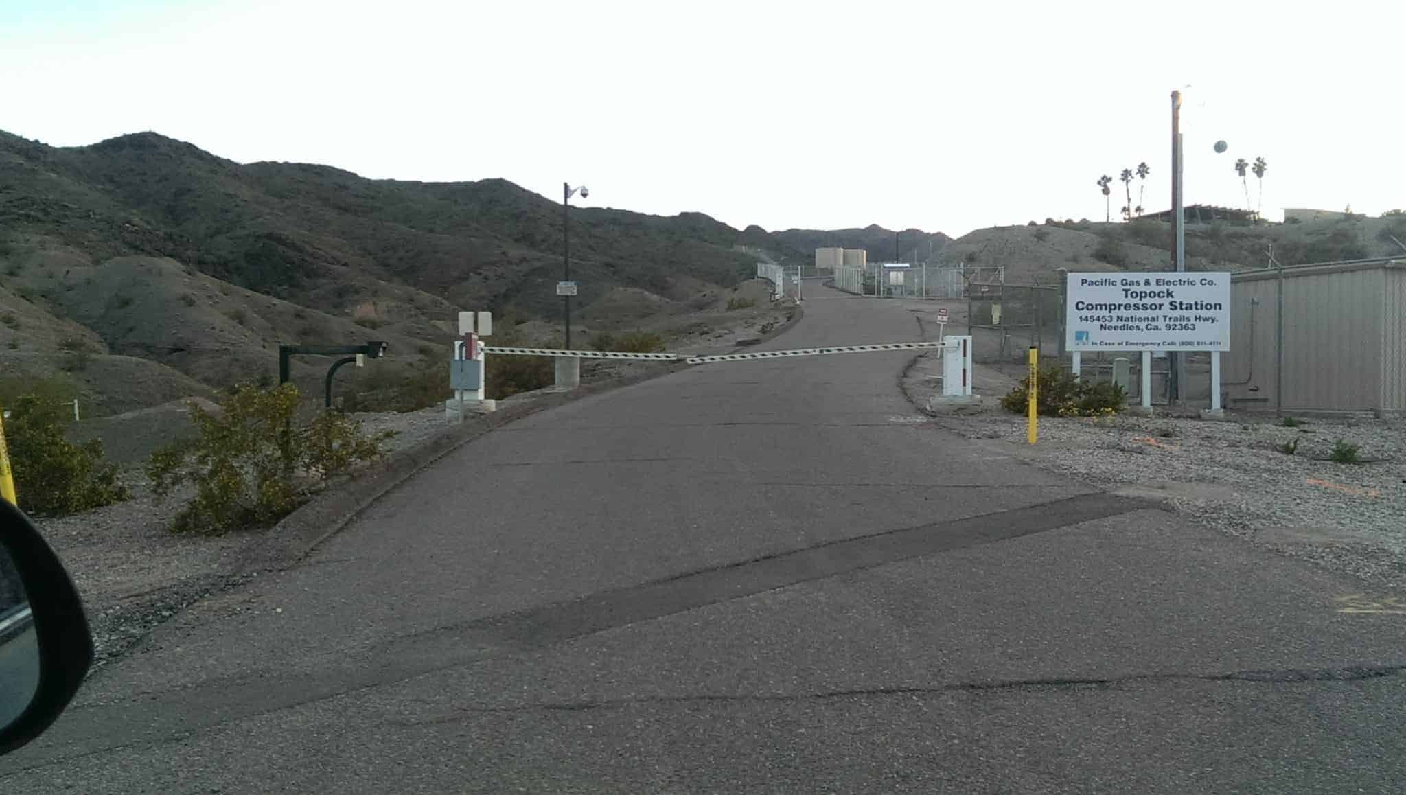
My completist urge was stymied when the biker/photographer told me the road had been washed out between Chambless and Essex, so we’d have to go north to I-40 to get around. But being the hardcore idiots we are, we drove through the desert to the point of closure and then drove back.
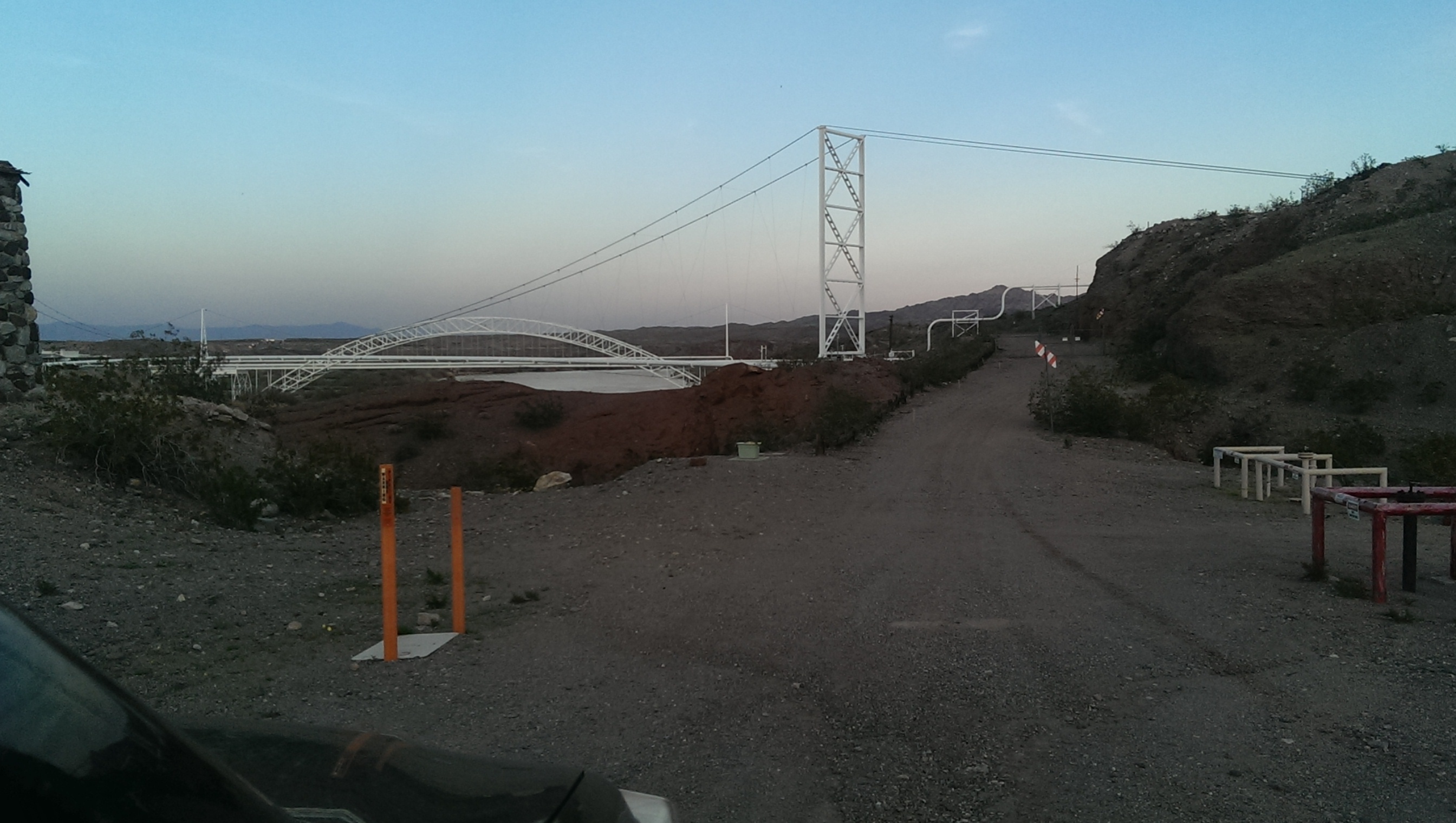
We tried to make it up later by running a spur of old, unmarked 66 to where it enters a utility property and then backing out, almost beside a 1916 bridge (Old Trails Arch Bridge) which once carries cars across the Colorado River as part of Route 66 but now supports a pipeline.
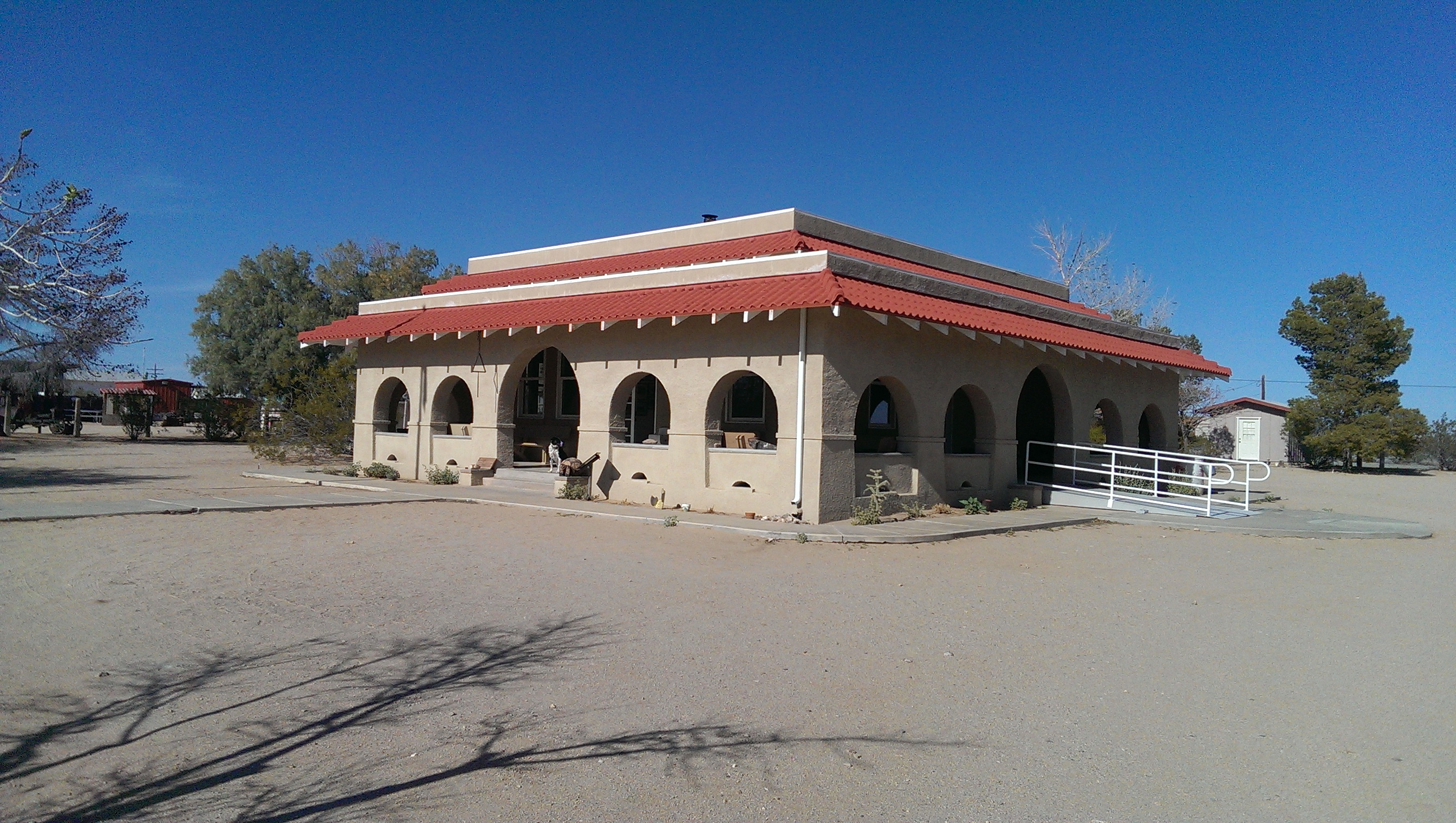
The Goffs one-room schoolhouse museum (no longer used as a school, because the two or three kids still in the area, population 29, are home-schooled) is full of not only schoolhouse memorabilia, but trails past and through all sorts of desert-found debris, including artifacts from General Patton’s training camps to teach World War 2 soldiers to fight in the North African desert. (photos above) We drove a bit down the road to where you can still pick out the lines of rock which lined the camp roads, now reclaimed by the desert.
The next post: Roy’s, in Amboy.
I have been really enjoying these blog posts. This whole collection of posts and photos should be compiled into a book! :D