This entry is part 17 of 17 in the series GDB & Route 66
One of the best parts of Route 66 is the old signs, many with neon, all with fun old design. And there are a few newer signs intended to blend with the vintage ones.
I took these photos on my Route 66 trip a few years ago, but in all the travelogue posts, I forgot to publish this one! Please enjoy this blast from the past.
So while I was cleaning the house — I do that every epoch or two, believe it or not — I found some index cards with plot notes. I’m not actually an index card plotter, but I did some detective work and determined, based on the debris strata and corresponding artifacts, that these were from a writers’ conference workshop from 2013, I think. We were supposed to invent a novel plot from scratch within the workshop.
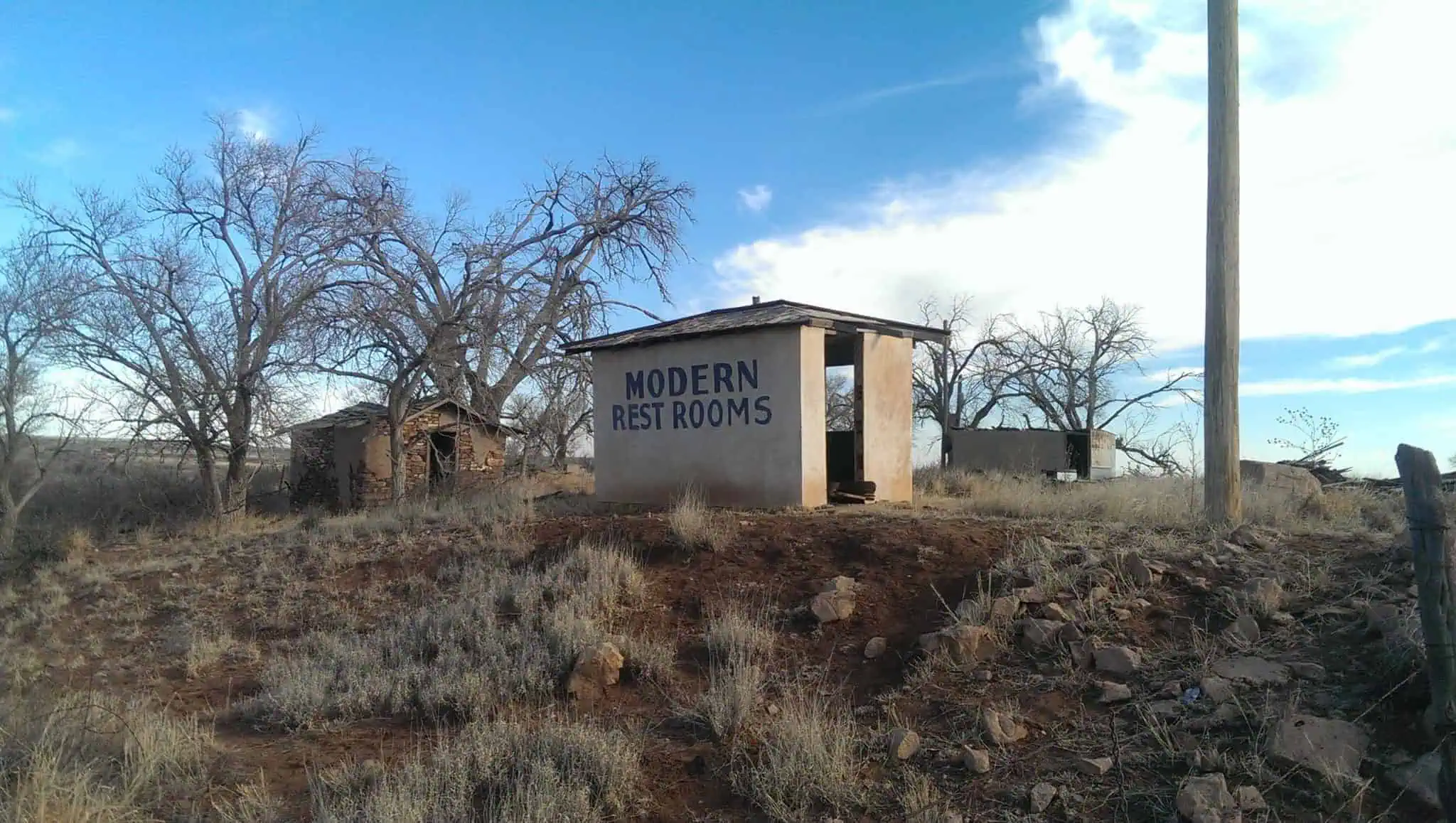
One of my favorite things about Route 66 is discovering relics of a previous age, America’s answer to ancient ruins.
Sally Sparrow: I love old things. They make me feel sad.
Kathy Nightingale: What’s good about sad?
Sally Sparrow: It’s happy for deep people.“Blink,” episode of Doctor Who, written by Steven Moffat
Route 66 is full of old things, and many of them are falling apart from decades of abandonment. Here’s a gallery of some of my favorite findings.
This entry is part 15 of 17 in the series GDB & Route 66
the Texas Longhorn Motel, or what’s left of it. “The First/Last Motel in Texas.”
Glenrio, as we saw on the eastern border of New Mexico, straddles the state line on an abandoned stretch of road. What shell is left of the Texas Longhorn Motel (“the First/Last Motel in Texas”) sits a few feet over the border, but there will be no guests.
Eastward, we come to Adrian, the geographical midpoint of Route 66 — probably depending on exact alignments, but who really cares to quibble? Adrian has 166 residents, per their sign, and I’m not going to begrudge them their midpoint status.
The gift shop and cafe across the street is adjoined by Sunflower Station, another boutique, where you can sign the pickup truck. We didn’t stop or take the time. That probably makes us Fake 66 Cruisers or something. Losers.
This entry is part 14 of 17 in the series GDB & Route 66
East of Santa Rosa, NM
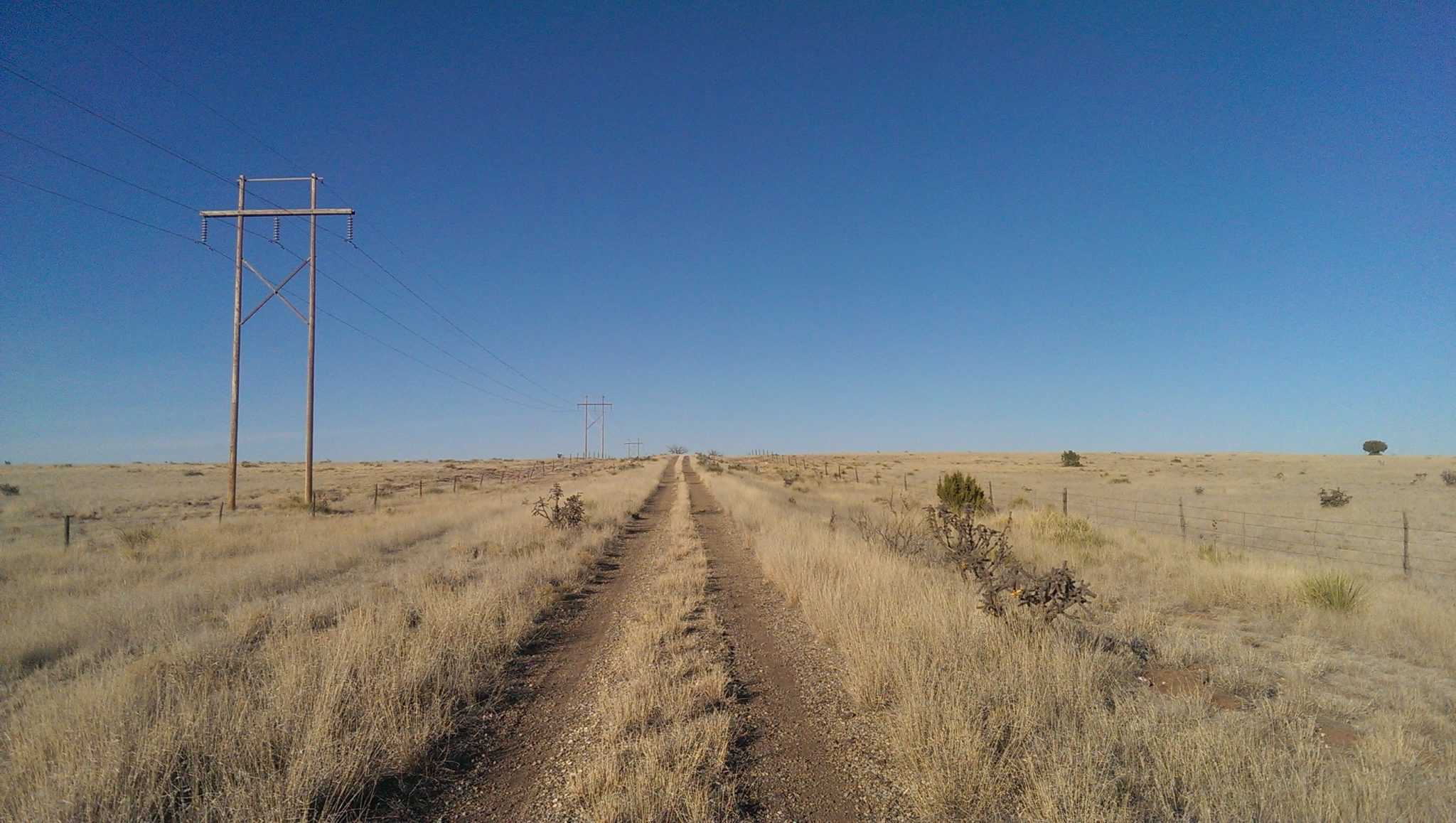
As the Route 66 series continues (and we have 5 states to go!), I thought I’d share a few thematic galleries of photos which might go together well but be lost in a state-centric post.
Today’s theme is the abandoned road. I’ve mentioned that we sought out many alternate alignments or discarded sections of old Route 66. Here are a few of my favorite pictures from those less-traveled segments!
This entry is part 13 of 17 in the series GDB & Route 66
Across the state line into New Mexico, the Land of Enchantment!
The first major city Route 66 reaches heading east is Gallup, immortalized in Bobby Troup’s obligatory Route 66 road song. The city sits close to the Hogback, a “ridge of upwardly tilted sedimentary rock” (The Place Names of New Mexico, by Robert Hixson Julya), and allegedly because of this geological constriction Gallup was a potential bomb target during the Cold War, as a single strike might have taken out railroad, pipeline, wired communications, and Route 66 all at once.
This entry is part 12 of 17 in the series GDB & Route 66
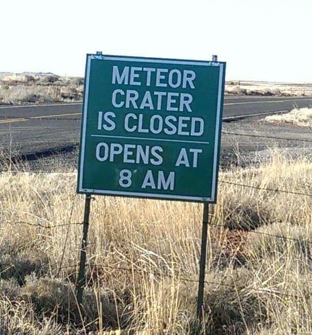
We ran west again from Winslow to pick up Meteor Crater, which was closed the night before and also was closed the last time I’d been through the area. (“Meteor Crater is closed.” Like they roll a mile-wide tarp across it at night, or maybe one of those motorized pool covers.)
A really, really big tarp, I’m telling you.
But I am (as astute readers might have noticed) a bit of a nerd, so we ran back the next morning to arrive just as they were unlocking the doors and presumably rolling up the tarp.
Meteor Crater
Meteor Crater is the site of the first crater impact to be recognized as such, and where impact science was basically re-invented. It’s an impressive hole in the ground. Best calculations by modern science suppose a 150-foot wide chunk of space rubble came screaming through our hundred miles of atmosphere in just 10 seconds before plowing into a pulverizing a sizable part of Arizona. Fragments scattered up to 7 miles around the site. The crater is three-quarters of a mile wide, and they think parts of a meteor sank as deep as 3,000 feet. Wow.
This entry is part 11 of 17 in the series GDB & Route 66
I’m behind in updating the actual travelogue for a number of reasons, not least of which is the photo-intensity of this trip, making backups and postings at typical hotel/motel speeds fairly draggy. While many old roadside motels are wonderful and equipped with all the modern conveniences, like the Roadrunner Lodge in Tucumcari, NM, others are not.
(One night I pulled in and asked first about internet access and second about vacancy. The owner/manager promised we would have internet. That turned out to be true only if I sat on the sidewalk outside the office, and even then my photo upload predicted it would finish at 8:16 the following morning.)
But there are a few notes common to all of Route 66 which I can share outside of chronological order.
This entry is part 10 of 17 in the series GDB & Route 66
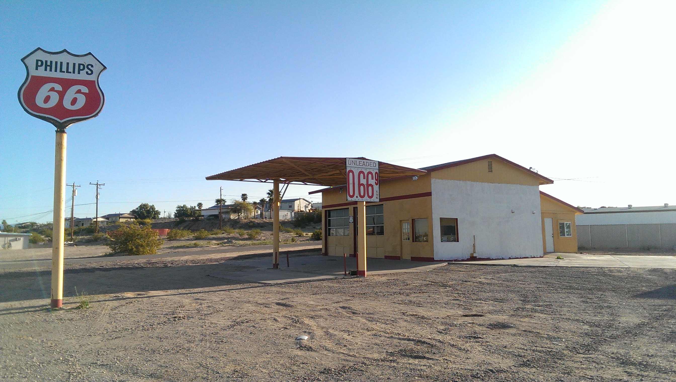
a restored Phillips 66 station
Remember, I’m reporting Route 66 from west to east, which is atypical. (I even found one guide which said running Route 66 from LA to Chicago was “historically wrong.” Like the whole highway was just a 2,400-mile one-way road.)
So here’s Arizona, from sunset to sunrise.
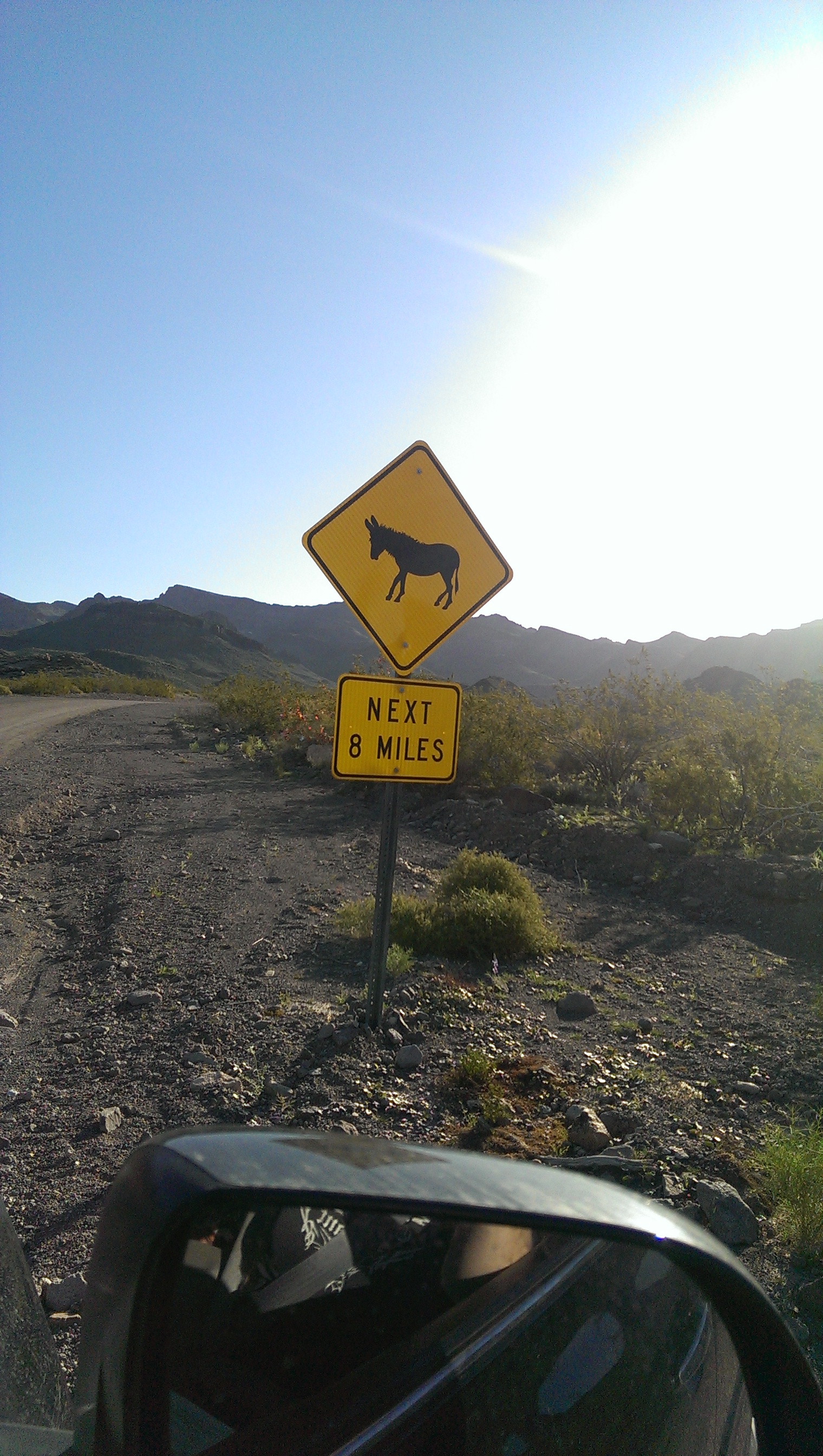
A Dearth of Burros
Oatman is famous for its feral burro population, descended from those escaped from or turned loose by prospectors in the (very rich) mining area. Tourists feed the burros, which wander down the street freely.
We arrived at Oatman early, and we shopped and we had breakfast, and….
Here’s a bit of Route 66 background, if you’re coming in late. If you’re all caught up, start the journey below!
The Drive
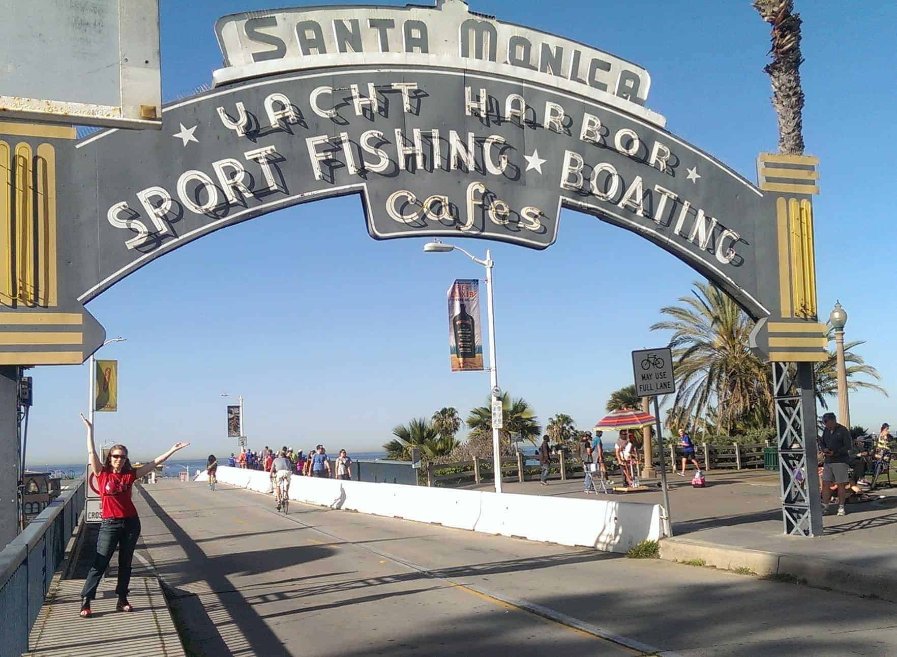
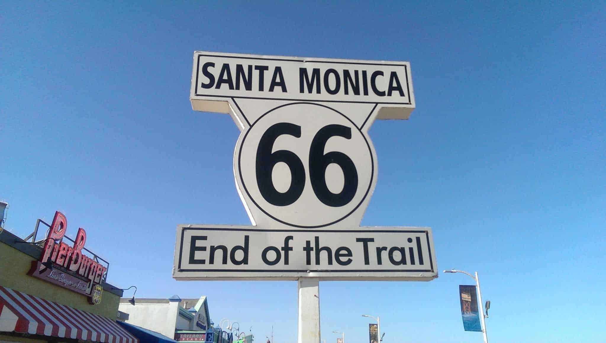
My plan was to drop Mindy at Guide Dogs for the Blind and then take Route 66 back to the Midwest. We started from Los Angeles to run eastward. The actual official end of the road, a couple blocks from the coast, is rather boring, so everyone collaboratively declares Santa Monica Pier to be the figurative end.